


NASA Goddard Space Flight Center: Earth Science Data for Humanitarian Aid
Humanitarian assistance to developing countries has long focused on countries having political, economic and strategic interest to the United States. Recent changes in global security concerns have heightened perception that humanitarian action is becoming increasingly politicized. This is seen largely driven by the “global war on terror” along with a push by donors and the United Nations for closer integration between humanitarian action and diplomatic, military and other spheres of engagement in conflict and crisis-affected states (HPG 2010). As we enter an era of rising commodity prices and increasing uncertainty in global food production due to changing climate, scientific data and analysis will be increasingly important to improve humanitarian assistance targeting. Earth science data enables appropriate humanitarian response to complex food emergencies arising in regions outside areas of current strategic and security focus.
As climate changes, new places will become vulnerable to food insecurity and will need emergency assistance. Earth science data and multidisciplinary models enable an information-based comparison of need, which goes beyond strategic and political considerations to identify new hotspots of emerging food insecurity. These analyses will improve aid targeting and timeliness, and reduce strategic risk by highlighting new regions at risk of crisis in a rapidly changing world. Improved timing and location targeting could reduce cost while increasing the likelihood that those who need aid get it.
Markets and Food Insecurity
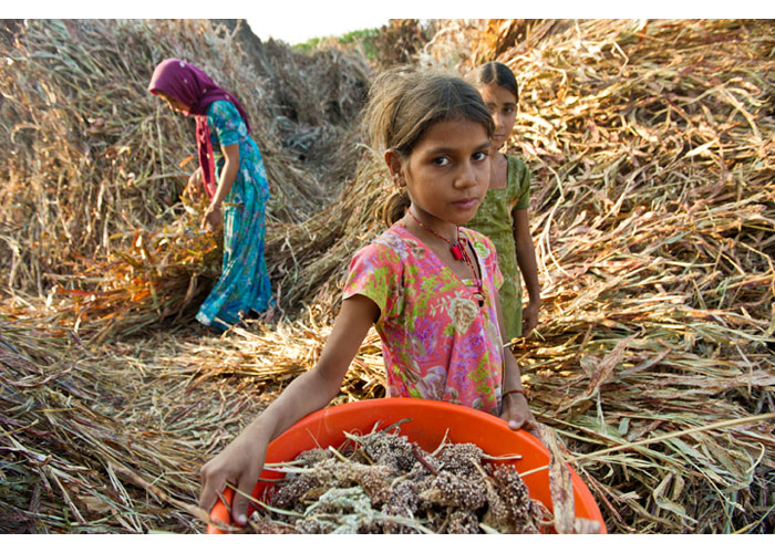
In food-insecure, agricultural regions many farmers both consume their product and sell it in local markets. This exposes them to climate variations because when farmers produce less their income goes down while costs go up to maintain basic food consumption for the family. Large-scale hunger can ensue even when sufficient food has been imported into the market from elsewhere. In Africa 95 percent of food consumed is grown on the continent (Funk et al. 2008). Thus, when wide spread food production declines exist, food security crises can occur, particularly for society’s most disadvantaged and marginalized segments.
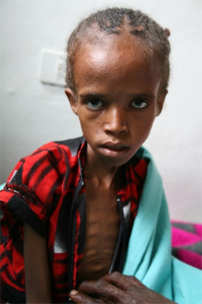
A severe drought in the summer of 2009 caused harvest failure in most of West Africa’s Niger. A serious food crisis followed the drought, which resulted in loss of assets, animals and other forms of savings. And, it left behind high levels of household debt. Niger’s total population is 15 million with an annual growth rate of 3 percent. The population living below the $1 per day poverty line is estimated at 65 percent and 20 percent is reported to be undernourished – one of the highest rates in the world. According to the United Nations’ World Health Organization, only 9 percent of the population has access to improved sanitation. In 2010 as a result of the severe drought, Niger’s harvest met less than a quarter of the country’s annual food requirements.
USAID/Ethiopia Photo by Kimberly Flowers
The general malnutrition and severe acute malnutrition rates in Niger reached very high levels in both rural and urban populations. In June 2010, 17 percent of the country’s children were suffering from global acute malnutrition. This figure was 36 percent higher than the previous year (Senahoun et al. 2011). Interviews with farmers and herders revealed that they considered the crisis to be as serious as the famine years of 1973 and 1984. They also believed the impact would linger for many years. In 2009-2010, 22 percent of total population was either highly or extremely food insecure. The country’s vulnerability to future shocks, such as rising food prices, and social and political unrest will remain heightened (FEWS 2011), thus requiring ongoing food production and local food price monitoring. Satellite remote sensing allowed an early indication of a failed harvest a month before the harvest and six months before the actual production figures were released by Niger. Thus, remote sensing provided an early warning sufficient to mobilize and to deliver humanitarian assistance when needed.
Changes in climate, coupled with the likely doubling of local population (particularly in Africa) in conjunction with at least two billion additional people to feed globally within the next two decades, make it very likely that food prices will continue to rise (Brown et al. 2009). Advent of large-scale use of food commodities in biofuels means the previously seen surplus in countries like the United States is rapidly disappearing (Cassman and Liska 2007; Gilland 2002). Higher food prices will affect not only urban populations in the developing world, but also most small farmers, the majority of whom are net grain purchasers. Thus, monitoring local food production in regions with low purchasing power is a key part of understanding vulnerability across societies.
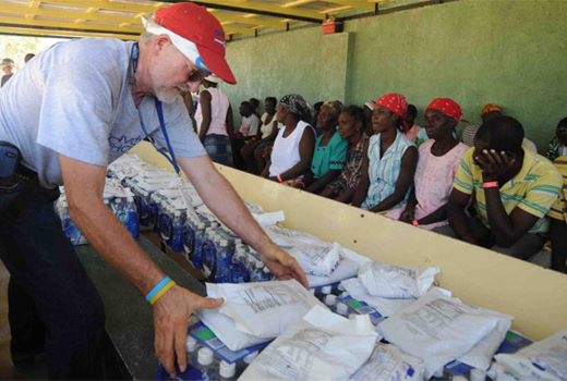
If resources are to be mobilized for such vulnerable countries as Niger, evidence needs to show that the weather conditions which cause human suffering along with the overall food security situation needs an immediate and prompt response. USAID is the world’s largest provider of food assistance with the Food for Peace Title II food aid program providing 2.4 million tons of food. This program, valued at $2.6 billion, benefitted more than 60 million people in 44 countries worldwide in 2009. These resources are delivered through direct food transfers, cash-assistance programs, locally-purchased food and medical assistance. Earth science data plays a key role in identifying where assistance is needed and in providing enough notice to enable prompt delivery.
Monitoring Global Agricultural Production
To effectively monitor agricultural growing conditions, earth observations of rainfall, temperature and other conditions form the knowledge base for food production. Earth science models, which integrate observations with ecosystem functioning, enable global assessments of regions that will experience widespread production declines resulting from adverse weather. U.S. government decision makers increasingly need information to be reliable, reproducible and comparable across regions and economies. When combined with deep knowledge of local context and an understanding of the causes of food insecurity, global agricultural production monitoring can be a powerful tool to provide an earlier early warning (Brown et al. 2007).
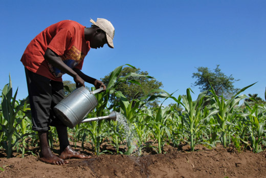
© iStockphoto.com/africa924|A farmer watering his field of sugar cane. The population of Malawi are mostly cultivated mainly sugar cane, a mainstay of the country.
Food security crises caused by droughts, floods and other severe events will affect more populations and in new places in the near future. New regions will become vulnerable to food crises due to what would have previously been considered small and isolated droughts. Tajikistan is a country that was food secure before geopolitical changes. Now, reduced agricultural productivity and a shrinking economy have left it vulnerable to drought. In 2011 the food security situation for poor non-agricultural households in remote areas of the country was dire due to high prices of basic staple foods. Fuel and food prices have continued to increase past their five-year high in most of the country and will continue to pose the main threat to households’ food security. The context in which weather-related shocks occur are as important to monitor as the weather itself.
The situation in Tajikistan is emblematic of the importance of earth science data and models, which allow continued food production monitoring in the country to ensure rapid and appropriate response if a drought were to occur this year. Satellite remote sensing observations and models enable improved decision making for humanitarian action. By quantifying risk to livelihoods from droughts, floods and other weather-related hazards, data enables improved understanding of comparative risks and humanitarian assistance needs across diverse regions. This data will reduce uncertainty, improve accuracy and timeliness, and increase fact-based decision making, which will open up the humanitarian space for action in an era of politicization.
Ph.D., Research Scientist, NASA Goddard Space Flight Center
molly.brown@nasa.govGlobal Challenges