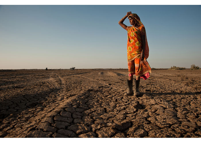


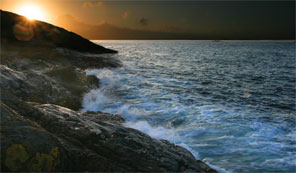
Global Warming and Lost Lands: Understanding the Effects of Sea Level Rise
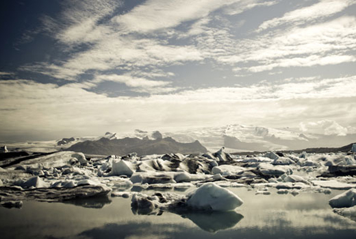
According to the United States Geological Survey (USGS), elimination of the Greenland Ice Sheet would create a potential sea level rise of 6.55 meters or approximately 21.5 feet. This increased water level would have an effect on more than 669,739,138 people around the world with an accompanying land loss of more than 5,431,902 (km2). The West Antarctic Ice Sheet is particularly vulnerable because most of it is grounded below sea level. A break-up of the two buttressing ice shelves would result in a rapid rise in global sea level of about 8 meters or 26.25 feet. This scenario is not even worst-case, which would include additional melting of the East Antarctic Ice Sheet, the Antarctic Peninsula, plus other ice caps, fields and glaciers for a total potential sea level rise of 80.32 meters or 263.5 feet. To put this into perspective, “a sea-level rise of 10 meters would flood about 25 percent of the U.S. population with the major impact being mostly on people and on infrastructures in the Gulf and East Coast states,” according to a USGS Sea Level and Climate report.
© iStockphoto.com/TAPshooter
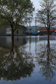
Even conservative estimates of an increased sea level rise of just 95 centimetres, or approximately 3 feet, by 2100 will create havoc in the United States because, according to the USGS, “prediction of shoreline retreat and land loss rates is critical to planning future coastal management strategies. To date, long-term planning for the Nation’s shoreline has been done piecemeal, if at all. Consequently, entire communities are being developed without adequate consideration of potential erosion, flooding and storm damage related to sea level rise.” In fact, the USGS suggests that approximately 27 percent of the U.S. East Coast shoreline is in the “very high” risk category with more than 20 percent in the “high” risk category, about 23 percent in the “moderate” risk category and just less than 30 percent in the “low” risk category. In other words, the entire East Coast shoreline is at risk.
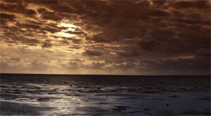
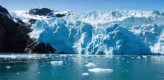
Regardless of the expedited impact of human-induced global greenhouse gases, the Earth’s natural cycle of long-term climate change and sea level rise is known to have had a devastating effect upon humans in prior periods. For example, experts agree that global sea level was about 125 meters, or 410 feet, below the current sea level at the last glacial maximum about 20,000 years ago. As the climate warmed, the sea level rose because of melting ice sheets. One disaster occurred when the sea level rose in the area now known as “the North Sea”; water doomed the people and the land.
© iStockphoto.com/remem
Global Warming and the Lost European Country
To many the North Sea is a stretch of grey uninteresting water crossed when going from England to France by plane or ship. Few people ever imagine as they make that journey that the murky waters cover a prehistoric landscape larger than the United Kingdom itself. However, people might well pause for thought if they realised that, between 10,000 and 7,000 BC, global warming raised sea levels and swallowed a vast, inhabited plain that had stretched without break from England to Denmark – an area so large that, effectively, Europe lost an entire country. Over the past 5 years, scientists and archaeologists in Britain have begun to use the latest technology to explore this lost world and to provide a dire warning about the impact of future sea rises.
In many ways the story of the people, culture and country that were lost began nearly 80 years ago in September 1931, when the trawler Colinda was fishing some 25 miles off the Norfolk coast near the Leman and Ower Banks in the southern North Sea. When trawlers fish, their heavy nets scrape the sea bed to haul in not only the catch of the day but also flotsam such as wood, shells, odd bones and even lumps of peat. Whether this day’s catch was less than usual or whether the crew was just bored, one lump of peat trapped in the net was broken open, and a prehistoric barbed point fell out. The find, a rather elegant artefact made of antler and measuring 8.5 inches in length, was probably used as a harpoon, a leister, a fish or an eel spear. The skipper of the Colinda, the wonderfully named Pilgrim E. Lockwood, was intrigued enough to take the find home. From there, it eventually found its way to the Castle Museum in Norwich.
© iStockphoto.com/JGTH
The Mystery of the Leman and Ower Harpoon
Archaeologically, the harpoon itself was not unique and was rapidly dated to the archaeological period known as the Mesolithic (c. 9,000 BC to 4,000 BC). However, what was different about the Leman and Ower point was where it was found – 25 miles from the coast of modern Britain. How had the “harpoon” arrived so far from land?
The mystery of the harpoon was eventually uncovered by a group of brilliant, young academics from Cambridge, most notably Grahame Clark (who later became Britain’s foremost expert on the Mesolithic) as well as Harry and Margaret Godwin, two dynamic botanists. They believed that new scientific techniques in geology and plant sciences could be used to explore and to explain how societies adapted to or changed with their environment. The study of plant pollen, preserved in geological or archaeological deposits, would allow the researchers to reconstruct the nature of past environments and even begin to trace change over time.
The Harpoon Tells a Startling Story
The journey to discover the importance of the harpoon began when the Godwins asked Pilgrim Lockwood for assistance. In 1932 the Colinda returned to the Leman and Ower banks to recover more of the peat that had encased the “harpoon.” The results were startling. Pollen indicated that the harpoon had come from fresh – not saltwater – and the surrounding environment was comparable to samples taken from dry land in the countries that now surround the North Sea. Clark quickly appreciated the significance of the results and concluded that evidence pointed to the existence of a great plain, inhabited by hunters, which stretched across the area of the North Sea 10,000 years ago and whose rising sea levels after the last ice age had inundated this land.
Unfortunately, the murky waters of the North Sea also placed this landscape far beyond the reach of modern archaeological prospection or exploration. In the absence of any practical method to explore this territory, the lands of the North Sea were gradually forgotten except, perhaps, as a land bridge across which Britain was colonised. However, archaeological material, bones and stone tools continued to be recovered from the North Sea. Interest was reinvigorated in 1998 by the work of Professor Bryony Coles, who drew upon all available knowledge to produce a series of speculative maps of the area that she called “Doggerland” after the great banks in the southern North Sea. Despite this, Coles concluded that “we have little more in the way of firm archaeological evidence than Clark had . . . in 1936.” The North Sea, therefore, remained terra incognita.
© iStockphoto.com/JGTH
Searching for a Lost World
However, a chance discussion in a University of Birmingham (UK) master’s class made Vincent Gaffney think about the lost land again. Although the area had largely been ignored by archaeologists, the discovery of oil and gas in the North Sea and the increasing extraction of gravel aggregate from the seabed meant that an immense amount of information had been slowly gathered about the sea and its geological history. Researchers at Birmingham began to speculate whether seismic data, collected for oil exploration, could also be used to locate buried features underneath the sea to explore this lost world. A hastily arranged meeting between archaeologists Vince Gaffney and Simon Fitch, along with Dr. Ken Thomson, a specialist in seismic processing, suggested that this might be a possibility.
Seismic survey is a technology often used by geologists to explore the subsurface of the earth and frequently chosen by the oil and gas industry for exploration. Usually surveys collect single lines of data – effectively showing a slice through the earth’s crust. However, more usefully for this project, 3D seismic data can also be collected. This data forms a digital cube that can be sliced horizontally and vertically to provide vertical profiles and horizontal maps of the land beneath the sea bed.
Uncovering a Lost World
The new research team approached a petroleum geology survey company, PGS, for sample data; and the first experiments were wildly successful. Within a short time the team produced the first plan of a river that flowed across the North Sea 10,000 years ago. The excitement at seeing these dramatic images emerge can hardly be described. The team felt like explorers of a completely unknown country. The first river was named the “Shotton” for Fred Shotton, a geologist from Birmingham; he is famous, among many things, for being dropped into occupied territory to map the invasion beaches and to ensure that they were suitable for the Allies’ heavy vehicles on D-Day (http://www.arch-ant.bham.ac.uk/shottonproject/profshotton.htm).
After this promising start a further 23,000 km2 of seismic data were donated by PGS Ltd. for study. The project area was now actually equivalent to Wales, a modern country! This time a group of researchers, funded through a grant from the aggregate industry, began working full-time on this huge amount of data. They began to map out the new country. At its centre was a huge lake occupying a great marine depression more than 100 km in length and now known to marine geologists as the “Outer Silver Pit.” This imposing area of water was surrounded by extensive plains, across which ran large river systems. Great estuaries formed where the rivers flowed into the lake and marshlands. One in particular, flanked by the lakeside, appears to have covered more than 300 km2. However, this was not a featureless landscape; low hills bounded valleys, and even individual hillocks could be discerned within the seismic images.
© iStockphoto.com/MaxFX
Global Warming and an Historical Warning
The country would have been a wonderful environment for hunters. Water abounded; fish, birds and other game would have been plentiful. The lakes and marshes would also have provided reeds for basketry. However, it is clear from the study that the landscape was changing and that it was, ultimately, doomed. As the waters rose, the estuaries of the rivers became wider; marshes extended. Eventually the sea broke into the great lake, and it became tidal estuary with fearsome rip tides. Gradually the land was inundated and lost.
What significance has such a story today? First we should note that these discoveries are not simply scientific novelties; a very real, human tragedy lies behind the loss of this immense landscape. The coastlines, rivers, marshlands and hills mapped during this project were, for thousands of years, parts of a familiar landscape to the peoples of Europe. Rivers would have been named; estuaries and low hills associated with ancestral memories would have become dear to these peoples. Insidious and slow overall, but terrifyingly fast at times, inundation must have been devastating for the people who lived here. Whole territories may have disappeared within the memory of generations. The distress caused by the loss of lands that supported communities and tribes is almost impossible for us to understand.
All was lost, along with the landscape itself, as sea levels rose and the land retreated. Disturbingly, these changes occurred as a consequence of sea level change equivalent to the rate currently predicted over the next century. It is a distressing fact that in Britain, in north western Europe and in the United States, most of the population and critical infrastructures are on the coast and, unlike the hunters of Mesolithic Europe, we will not be so mobile or as flexible in the face of rapid and possibly catastrophic sea rise.
At a time when global warming and sea level rise are now accepted as amongst the greatest threat to our lifestyles, the fate of the landscapes and peoples of the North Sea may yet be interpreted not as an academic curiosity but as a significant warning.
Mitigating Disaster: The Potential Beyond the Study
The long-term goal of this study is to provide an indication of how this material from the North Sea could contribute to the world’s understanding of how rapid climate and sea level change influence landscape development and human activity. If detailed environmental modelling and reconstruction can be combined with the seismic data, there are applications in seabed engineering and international heritage management strategies for the continental shelf.
With respect to the U.S. East Coast’s extreme exposure to the effects of sea level rise, this new technology, partnered with the region’s seismic data collected for oil and gas exploration, could offer new information and options to mitigate what may be an otherwise impending disaster.
For more information on this project and the applications of this new technology, please contact Professor Vincent Gaffney at the University of Birmingham via email at: v.l.gaffney@bham.ac.uk. For more detail on Dr. Gaffney’s projects please go to: www.iaa.bham.ac.uk/computing/HP_VISTA/HPindex.htm.
Download Dr. Gaffney’s complete, unedited article with additional images here. (2.4MB pdf)
Global Challenges